Experiences

Mountain Treks

Tanzania rises from sea level to 5,895 metres. Along the way are some of the most dramatic and varied mountain landscapes on the planet — and four treks that define what it means to earn a view.

01

Summiting Kilimanjaro via the Machame Route

Mount Kilimanjaro summit at dawn

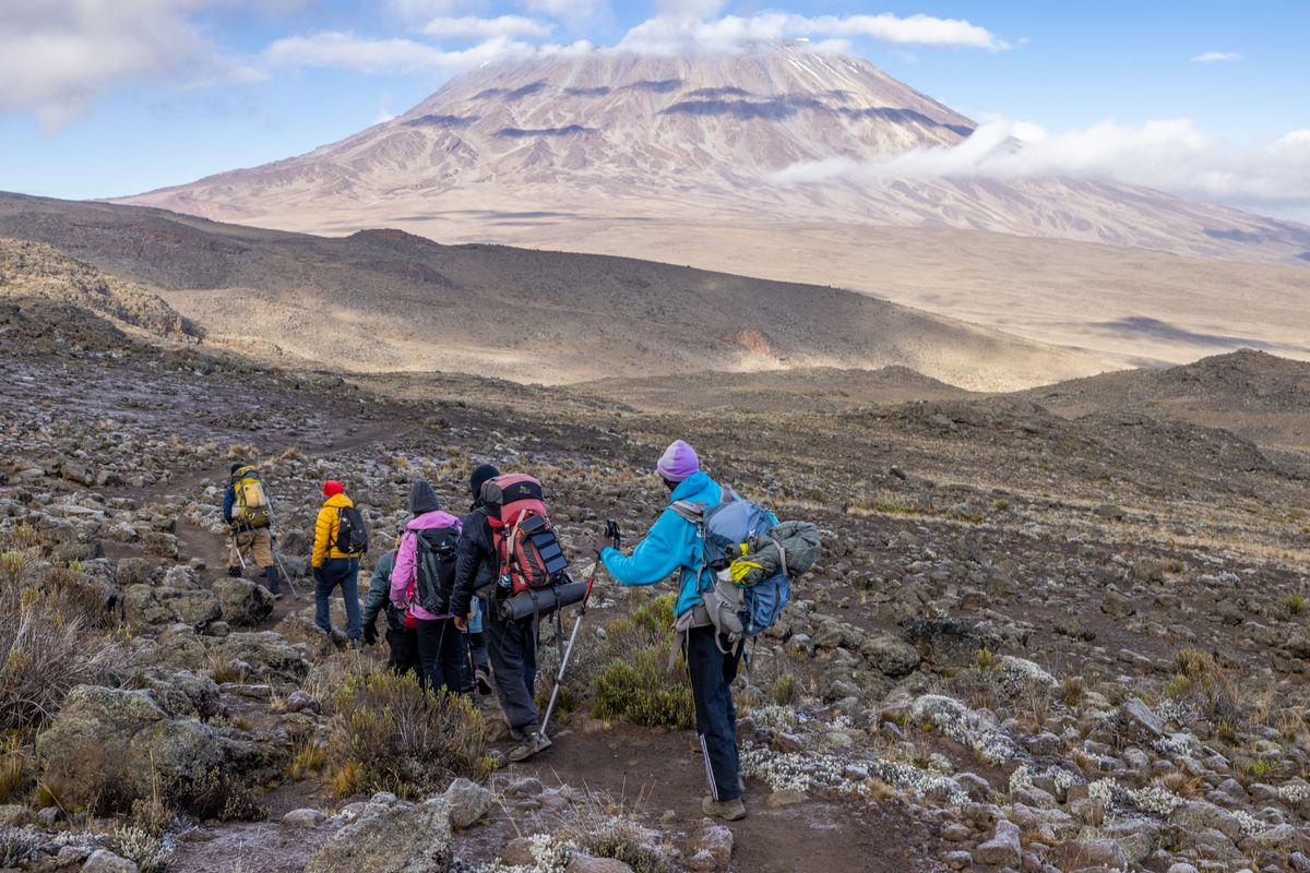
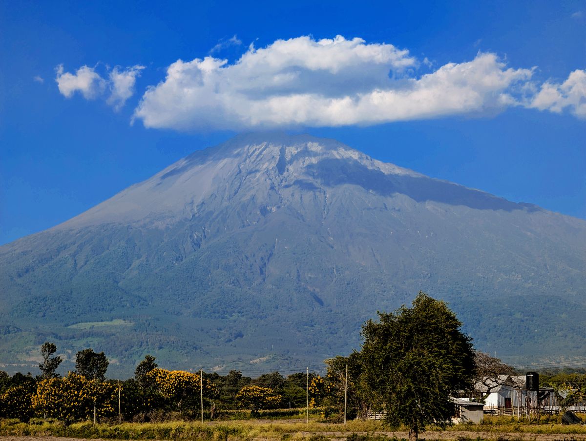
They call it the Whiskey Route. Not because there is any whiskey involved — there isn't — but because of its reputation as the demanding alternative to the gentler Marangu "Coca-Cola Route." The Machame earns its name.

The route begins in the rainforest at 1,800 metres, where the canopy drips and colobus monkeys move silently through the branches overhead. Over six or seven days, it climbs through five distinct climate zones — heath and moorland, where giant lobelias stand sentinel in the mist; the lunar alpine desert, where the temperature drops below zero at night and the air is thin enough to make every uphill step a negotiation; and finally, the glaciated summit zone, where ancient ice fields glow blue in the predawn darkness as your headlamp sweeps across them.

Summit night begins at 11 pm. The temperature at Stella Point, the crater rim, is typically between -10°C and -20°C. The altitude — 5,756 metres — reduces the available oxygen to roughly half what you breathe at sea level. Most people are moving slowly, deliberately, with a focus that narrows down to the next step and then the next step after that. And then the sky begins to lighten, and Uhuru Peak appears, and the whole of Africa appears to be below you, and the feeling — exhaustion and wonder in equal measure — is not something that language handles well.

Plan This Trek

  • Best seasons: January–March and June–October (dry conditions)
  • Licensed guide and porters mandatory — tip generously, they carry your world
  • KINAPA park fees: approx. USD 70–80 per person per day
  • Summit success rate on 7-day Machame: approximately 85%
  • Train 3–6 months in advance — cardiovascular fitness is paramount
02

The Lemosho Traverse

Vast highland landscape of Tanzania

If the Machame is the most dramatic route to the summit, the Lemosho is the most complete. It begins in a remote forest on the mountain's western flank and traverses the entire Shira Plateau before turning for the top — a journey that gives the mountain its full context.

The Lemosho's distinguishing feature is its approach. The starting point — Londorossi Gate at 2,100 metres — is accessed through a wild, undeveloped section of forest that few trekkers ever reach. Buffalo move through the undergrowth in the early morning. The air smells of cedar and wet earth. By day two, you emerge from the forest onto the ancient Shira Plateau, a vast volcanic tableland at 3,800 metres with views that stretch from Kilimanjaro's snowfields to the plains far below — and, on clear days, all the way to Mount Meru rising from the haze.

The extra day built into the Lemosho's itinerary — compared to the Machame — provides meaningful acclimatisation time, and this translates directly into summit success rates. The Lemosho consistently produces the highest summit rates of any route on the mountain. For those who want the best chance of standing on Uhuru Peak while also experiencing the most scenically complete version of the climb, there is no better route.

Plan This Trek

  • 8-day itinerary strongly recommended over 7-day for acclimatisation
  • Lower traffic than Machame — better solitude on the mountain
  • Joins the Machame route at Lava Tower (4,600m) for the final summit push
  • Highest summit success rate of all Kilimanjaro routes
  • Fly into Kilimanjaro International Airport (JRO); Moshi is the base town
03

Mount Meru: The Forgotten Giant

Wildlife in the highlands near Arusha

Everyone goes to Kilimanjaro. Almost no one goes to Meru. This is, depending on your perspective, either a shame or a secret — because Mount Meru, Tanzania's second-highest peak, may offer a more dramatic, more technically interesting, and more intimate mountain experience than its famous neighbour.

At 4,566 metres, Meru is not a small mountain. It sits inside Arusha National Park, less than 70 kilometres from Kilimanjaro, and its active volcanic crater is one of the most dramatic geological features in East Africa. The route to the summit — via the crater rim — involves an exposed knife-edge ridge at altitude that requires focus, nerve, and a good head for heights. The views from the summit on a clear morning include Kilimanjaro rising above the cloud layer to the east — a sight that is, uniquely, impossible to see from Kilimanjaro itself.

The approach through Arusha National Park adds a wildlife dimension entirely absent from Kilimanjaro. An armed ranger — mandatory on Meru — accompanies all climbers through the lower forests, where Cape buffalo, elephant, and giraffe are regularly encountered at close range on foot. Colobus monkeys inhabit the fig forest at mid-altitude. The mountain is, in every way, alive — and the absence of the crowds that define Kilimanjaro makes every element of the experience feel more present and more real.

Plan This Trek

  • Armed ranger mandatory — included in park fees, not optional
  • Excellent acclimatisation climb before a Kilimanjaro attempt
  • 3-day route is achievable; 4 days strongly preferred for pacing
  • Hut accommodation available at Mirikamba and Saddle Huts
  • Base in Arusha — 25km from the Momela Gate park entrance
04

Hiking the Ngorongoro Crater Highlands

Aerial view of the East African highland landscape

In the highlands above the Ngorongoro Crater, the earth curves away in every direction. Cattle move across the rim in long, slow lines. Maasai herders stand on one leg, watching. The volcanoes — Ngorongoro, Olmoti, Empakaai — recede into the haze one after another, ancient and unhurried.

The Ngorongoro Crater Highlands offer a type of walking safari unavailable almost anywhere else in Tanzania — multi-day trekking through a cultural landscape that is simultaneously one of the most dramatic volcanic environments in Africa. The Empakaai Crater, a two-hour walk from the road, holds a deep soda lake that turns pink with flamingos in the late afternoon. The Olmoti Crater, shallower and grassier, is patrolled by buffalo and bushbuck. Loolmalasin, at 3,648 metres, is the highest point in the entire Ngorongoro Conservation Area and rarely climbed.

The trekking here is not technical. But it is demanding — long distances on foot at altitude, through terrain that alternates between montane forest, open moorland, and the rim paths of ancient calderas. A Maasai guide is essential, both for navigation and for the conversations that happen along the way. These highlands are still lived in, still grazed, still sacred — and to walk through them with someone whose family has been here for generations is to understand why the Maasai call this land Engikaret Olmotonyi — "the place where God lives."

Plan This Trek

  • Best combined with a Ngorongoro Crater game drive
  • Maasai guide required — arranged through NCAA (Conservation Area Authority)
  • Wild camping on the crater rim and in the highlands; bring all equipment
  • June–October: dry season, clearest views; April–May can be muddy
  • Entry fees payable at Ngorongoro Conservation Area gates

More Experiences

Ready to Climb?

Whether it's your first mountain or your fiftieth, we'll match you with the right route and the right team.

Start Planning